
Photo & Video Chronology — June 18 & 20, 2025 — Before and during episode 26 at Kīlauea summit
By Hawaiian Volcano Observatory
June 23, 2025
Episode 26 of the Kīlauea summit eruption was active for 9 hours on June 20. High fountains during episode 26 reached approximately 380 meters (1246 feet), the highest yet recorded during the ongoing eruption, which began on December 23, 2025.
Media

Episode 26 of lava fountaining during the ongoing Kīlauea summit eruption began just after midnight, on June 20, and reached heights of over 300 meters (1000 feet). From the northwest rim of the caldera, USGS Hawaiian Volcano Observatory geologists observed the fountains supplying lava to swiftly flowing lava channels that extended into the eastern portion of the crater floor. USGS photo by M. Patrick.
Sources/Usage: Public Domain. View Media Details
Media

The appearance of layers in the fountains represents discrete pulses at the base of the fountain, highlighting the dynamic nature of lava exiting the vent. The fountain supplied lava into channels that flowed north along the edge of the crater floor, into the eastern crater. USGS photo by M. Patrick.
Sources/Usage: Public Domain. View Media Details
Media

A close-up view of the base of the north fountain during episode 26, as well as the start of the lava channels draining the vent craters. These channels often had standing waves, resembling a fast-moving river. USGS photo by M. Patrick.
Sources/Usage: Public Domain. View Media Details
Media

Visitors in Hawai‘i Volcanoes National Park enjoy a clear view of the episode 26 lava fountains from Kīlauea overlook. USGS photo by M. Patrick.
Sources/Usage: Public Domain. View Media Details
Media

A view of the complex flow of lava exiting the north vent crater at Kīlauea summit during episode 26 of the ongoing eruption. USGS photo by M. Patrick.
Sources/Usage: Public Domain. View Media Details
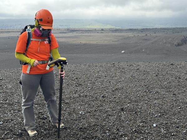
Media

A USGS Hawaiian Volcano Observatory geologist collects video and makes observations of lava fountain behavior on the western caldera rim during the morning on June 20. USGS photo by M. Patrick.
Sources/Usage: Public Domain. View Media Details
Media
A USGS geologist surveys the height of the new tephra cone formed by the recent lava fountaining episodes at the summit of Kīlauea. This tephra cone now towers over, and covers, Crater Rim Drive, which has been closed to the public since 2008. The cone is over 20 meters (65 feet) above the pre-eruption ground surface, and the scale of this growth can be seen by the vehicle in the distance, which is close to the original ground surface level. USGS photo by M. Patrick.
Sources/Usage: Public Domain. View Media Details
Media

Lava fountaining remained paused on Wednesday, June 18, nearly a week after episode 25 produced impressive lava fountains at Kīlauea summit. HVO geologists on the rim observed cycles of gas pistoning in the north vent, associated with a small amount of visible spatter and loud jetting sounds. USGS photo by M. Patrick.
Sources/Usage: Public Domain. View Media Details
Media

Cycles of gas pistoning were observed in the north vent, at Kīlauea summit, by USGS Hawaiian Volcano Observatory geologists looking down upon the vent from the caldera rim on June 18. The peak of each cycle produced loud jetting sounds and a brief glimpse of spatter, but the lava column was not visible and no lava flows were produced. USGS photo by M. Patrick.
Sources/Usage: Public Domain. View Media Details
Media

Tephra deposits from the recent lava fountaining at Kīlauea summit have blanketed the western caldera rim, killing much of the vegetation in this area. Nevertheless, some plants are starting to sprout up again through the cinder. The resilient ‘ama‘u fern is pictured here; the ‘ama‘u is an endemic plant and is often one of the first plants in Hawaii to colonize new volcanic landscapes. USGS photo by M. Patrick.
Sources/Usage: Public Domain. View Media Details
Media

Thick tephra deposits downwind (southwest) of the active vents at Kīlauea summit have covered roadways used to access critical monitoring equipment, requiring 4wd to navigate to these instrument sites. USGS photo by M. Patrick.
Sources/Usage: Public Domain. View Media Details